
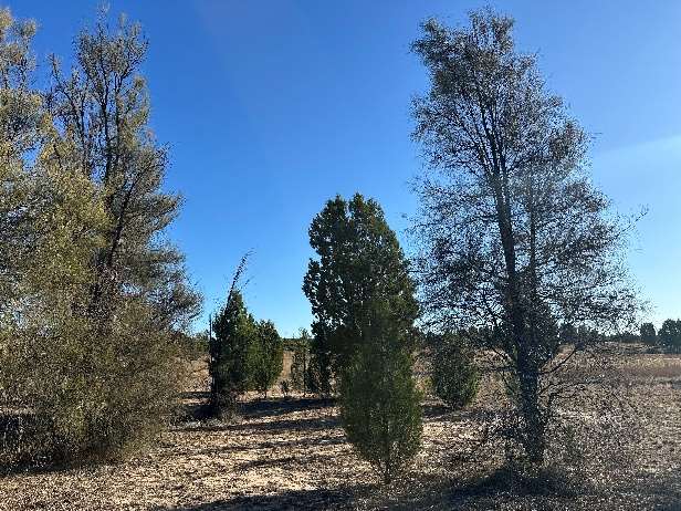
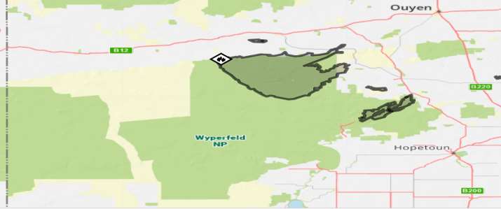
Whilst fire is a natural event and large wildfires from lightning strikes are relatively common in the Mallee Environment, the significant fire event of January 2026 is likely to have caused permanent change to some vegetation communities. This fire burnt nearly 56,000 ha in Wyperfeld National Park, 75% of which was Mallee / Heath / Broombush, which will slowly grow back, however, 25% was Semi-Arid Woodland (SAW), which is EPBC listed and very slow to regenerate. The bushfire also heavily impacted very old riparian River Red Gum (Eucalyptus camaldulensis), Black Box (Eucalyptus largiflorens) Woodland and lakebed herbland, which had survived past lower intensity fires.
As the area’s name ‘Pine Plains’ implies, there were significant Slender Cypress-Pine (Callitris gracilis) old growth and regrowth stands, and Buloke (Allocasuarina luehmannii) present (the woodland type referred to as SAW), which has now been decimated. Much of this area was already burnt in a bushfire 12 years ago (2014), so a catastrophe on a previous catastrophe. Semi-Arid Woodlands (SAW), particularly Buloke woodlands, are a direct result of a time when the climate was wetter. In this now largely dry climate, most regeneration only occurs after above average rainfall years and when grazing pressure is very low.
As usual, this fire started due to lightning late on Thursday, January 8th, 2026. Strong winds on Friday caused the fire to breach its containment lines and under the influence of extreme fire weather conditions the bushfire went Pyrocumulonimbus and swept across Pine Plains and into the Patchewollock State Forest. The lightning generated by the Pyrocumulonimbus ignited 2 other fires in eastern WNP, 25 km ahead of the fire front, that combined to form another ~2000ha bushfire.
*Pyrocumulonimbus (PyroCB) clouds are dangerous, fire generated thunderstorms formed by intense heat from bushfires. These clouds develop when extreme heat triggers rapid updrafts, carrying smoke and moisture high into the atmosphere, often creating their own weather, including lightning, strong winds, and even tornadoes.
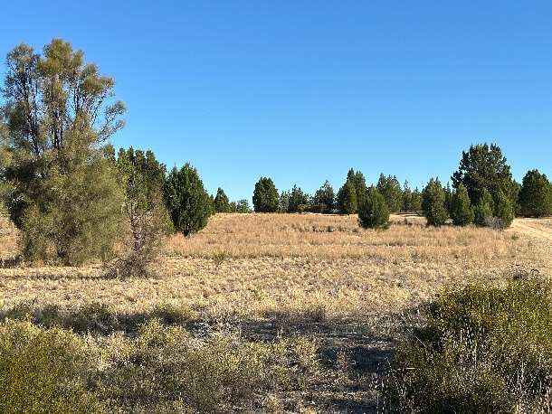
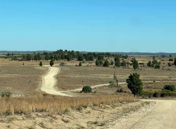
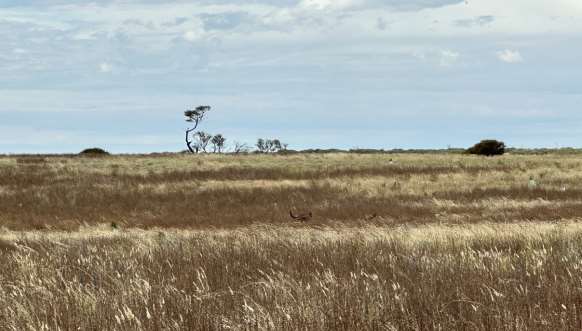
Since the Pine Plains area was added to Wyperfeld National Park (WNP) in 1996, grazing pressure has been continuously and intensively managed. The area was once grazed heavily by Cattle, Sheep, Goats, Rabbits and Kangaroos. Cattle and Sheep have been removed entirely, Rabbit numbers have been reduced from 100+ Rabbits per transect kilometre to less than 1 Rabbit per transect kilometre, Goats have been managed and Kangaroo numbers are kept to a sustainable level. The planned removal or management through significant population reduction of these grazing animals has resulted in considerable vegetation regeneration, particularly ground cover and Native Pine. Whilst hot fires can destroy most young (under 10 year old) regeneration, Kangaroos that have survived will be looking for food and will eat any vegetation that escaped the fire. They will also be attracted to “green pick”, which essentially is any grasses or vegetation that emerge after rainfall. Grazing by Kangaroos after the bushfire will be exacerbated by Rabbit and Goat grazing, which means the combined grazing pressure will prevent successful regeneration, if grazers are not proactively managed.
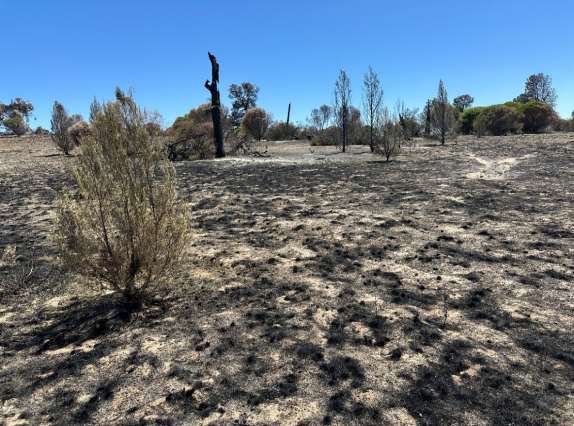
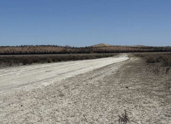
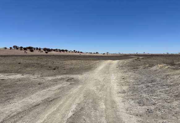
Threatened Mallee Birds (TMB) (EPBC listed) and their habitat have also been impacted. All fires in the Mallee and Heathland vegetation surrounding Pine Plains have impacted known populations and habitat that is very important for Malleefowl (Leipoa ocellata), Red-lored Whistler (Pachycephala rufogularis), Southern Scrub Robin (Drymodes brunneopygia), Crested Bellbird (Oreoica gutturalis), Crested Quail-thrush (Cinclosoma castanotum) and Mallee Striated Grasswren (Amytornis striatus howei).
Whilst much of the Mallee / Heathland communities and TMB have now been significantly impacted by two previous bushfires, they should hopefully recover with time and rainfall. The scale of the bushfire and the loss of many very old Scrub Cypress-Pine (Callitris verrucosa) refuge areas is, however, likely to impact on their ability to successfully recolonise this environment.
One of the better researched and studied birds in the Semi-Arid Woodlands (SAW) is the Pink Cockatoo (Cacatua leadbeateri). About 70% of their habitat in Pine Plains has been severely impacted as a result of this fire. It is likely that most of the remaining very old, hollow bearing trees were reduced to ash on the ground. Monitoring over the last 20 years has shown that this area is the largest breeding colony of Pink Cockatoo in Australia. This fire has come after decades of successful grazer control which resulted in widespread (but sparse) natural regeneration of Slender Cypress-Pine, the key nesting tree and food species for Pink Cockatoo. Whilst the 2014 bushfire caused significant loss of old Slender Cypress-Pine, this recent fire is likely to have claimed most, if not all, of the remaining old trees in the fire area. It was much hotter and more intense than the 2014 bushfire and ripped through extensive areas of natural Pine regeneration and also revegetation areas that were up to 15 years old. This habitat destruction will of course impact significantly on the breeding capability of remaining adult birds for many years. Recovery for this critically endangered species will depend on their ability to find new breeding hollows.
River Red Gum and Black Box along the Wimmera Heritage River (WHR) and around some dry lakebeds in Pine Plains have been “hanging on” for decades. It is possible that occasional regeneration may occur after significant rainfall events. In this recent fire, it is expected that many old trees around the dry lakebeds will have been destroyed by the high intensity fire and are likely gone forever. There remains significant areas of riverine vegetation along more southerly extents of the WHR, so whilst devastating for Pine Plains, species like the Regent Parrot (Polytelis anthopeplus monarchoides) are less likely to have been catastrophically impacted.
Now that the fire is out, the assessment and recovery process has already commenced. Regeneration for most flora will be very slow, and highly dependent on good rainfall over the area. Despite good rainfall, not all fire impacted vegetation is likely to regenerate. River Red Gum, Black Box and Buloke fire impacted trees may never regenerate. Slender Cypress Pine is likely to regenerate over time and with ongoing annual management of grazing pressure. The most likely successful regeneration will develop from the Mallee / Heathland communities and native grasses. Weed species may also proliferate in certain areas. In some areas, revegetation may be an option, however it is very expensive, time consuming and the success rate can be low depending on climate drivers. Vigilant annual grazing management will also have to be a key priority if any new vegetation is going to survive.
This environment has been changing for decades, as the WHR system dries out. The bushfire will have caused devastation to the old Riparian Zone and to the SAW communities. Future management of the bushfire area will have to support unknown future changes and heightens the need to protect other similar areas as Climate Change continues drying and weather changes cause more catastrophic fires to develop.
Author: Kym Schramm
Former Ranger in Charge (2001-2007),
Wyperfeld National Park